White Mountain Peak
15 January 2018
Every now and again I experience a fit of pent up rage / energy to such an extreme degree that its release requires an equally severe and prolonged bout of unadulterated physical exertion. No rational explanation can be made as to the satisfaction derived from these labors. Many have tried, desperately, to understand this phenomenon and all have failed. Perhaps an act so senseless is required to counterbalance the equally absurd nature of life as it proceeds on our cosmic hurtling rock ball Earth. Maybe it is some latent evolutionary remnant in those of us dragging along more primordial minds, in that a certain pleasure is found while engaging in the hunt for food or in this case the mountain summit. Or the view from the top is really that good.
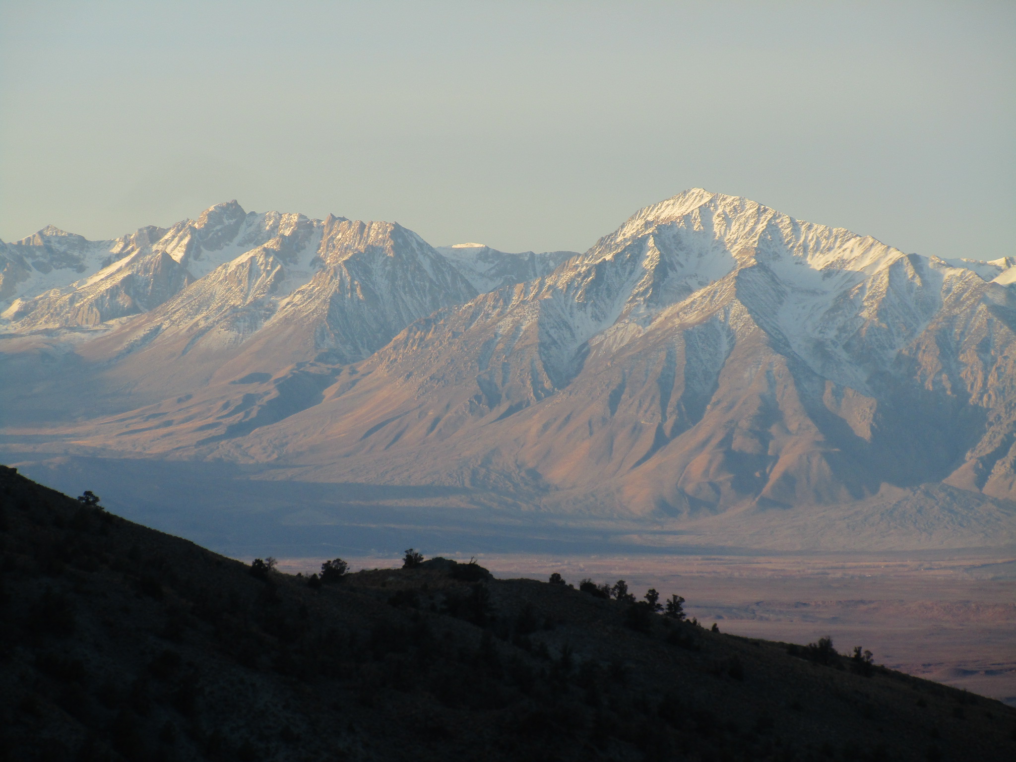
I suppose within these impenetrable existential frameworks lie the keys to happiness. 2017 had been a terrible year by all accounts and in many ways I just wanted to start the year on a solid footing. And so it was that at 4:30 in the winter’s morning I rose from ‘The Pit’ climber campground in Bishop and set out for the western foot of White Mountain Peak, which rises some 9000′ above the Great Owens Valley Floor. A day hike of the highest order would constitute the day’s affairs.
I’m usually loathe to detail the background information required to complete some of these adventures, and indeed, often I equip myself only with compass, altimeter, topographic map and perhaps some vague recollections of a Summitpost route page in order to get there and back again. And in actuality this hike was no different! The Summitpost user ‘PellucidWombat’ put together a really nice route page for the West Ridge which I read and attempted to commit to memory before embarking on the adventure.
White Mountain Peak, West Ridge Route
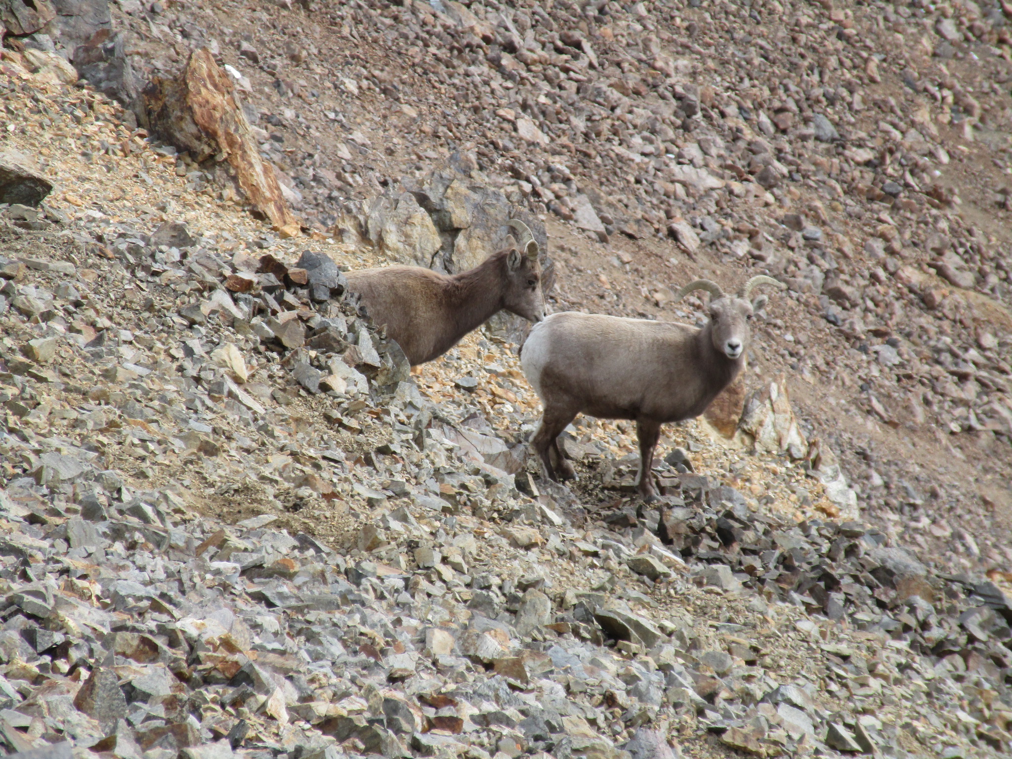
2017-18 saw the return of Winter, Light Version to the Sierra Nevada. Owing to the dry conditions prevailing on my even drier peak I bore approach shoes and left the ice axe at home. This made the scrambling bits on the ridge above 12000′ especially easy. I was able to rock hop around just about any snow patches the entire time, save for a stretch just below the final summit plateau.
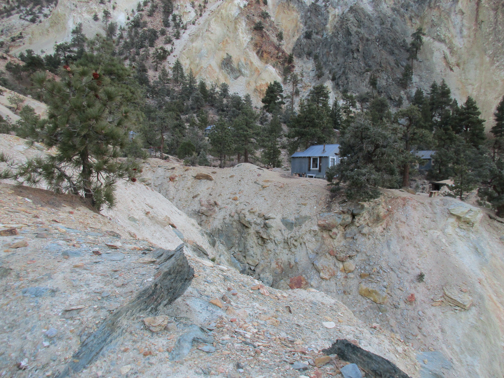
The approach hike was a classic grinder, first up the dirt road, where brilliant glowing cattle eyes could be seen hovering ominously among the rocky fields, then into the wash and the canyon, and up to a nice rest area at the Black Eagle Camp. I was in such a rush I neglected to peer into the cabins, but they had a distinct Goldilocks-style appeal and appeared to be meticulously maintained. A nearby sign detailed the work of volunteers in this regard — awesome!
I continued following a use trail to the upper mine as delineated by the nice sign put up by the volunteers. This put me on the north spur variation of the west ridge. The PellucidWombat warned of bushwhacking, but I found the terrain to be wide open enough for relatively easy passage. The rocky gendarmes proved the greater nuisance as traversing these beasts was quite time consuming.
Soon I found myself beneath the mother of all scree slopes, described as such by Diggler:
“The N spur of the W ridge joins with the S one above this notch. Above this low-point looms an ugly, 1000’ tall scree slope that must be surmounted. It is as bad as it looks, & quite possibly worse on the descent (much ankle-twisting potential)”
I consulted my peakbagging standard operating procedure manual and of course Section Scree called for a transition to four-wheel drive mode. I got onto my hands and motored up the damned slope like an ape out of hell. Nevermind the sliding up and down again: with enough mad determination any such slope may be surmounted in due time.
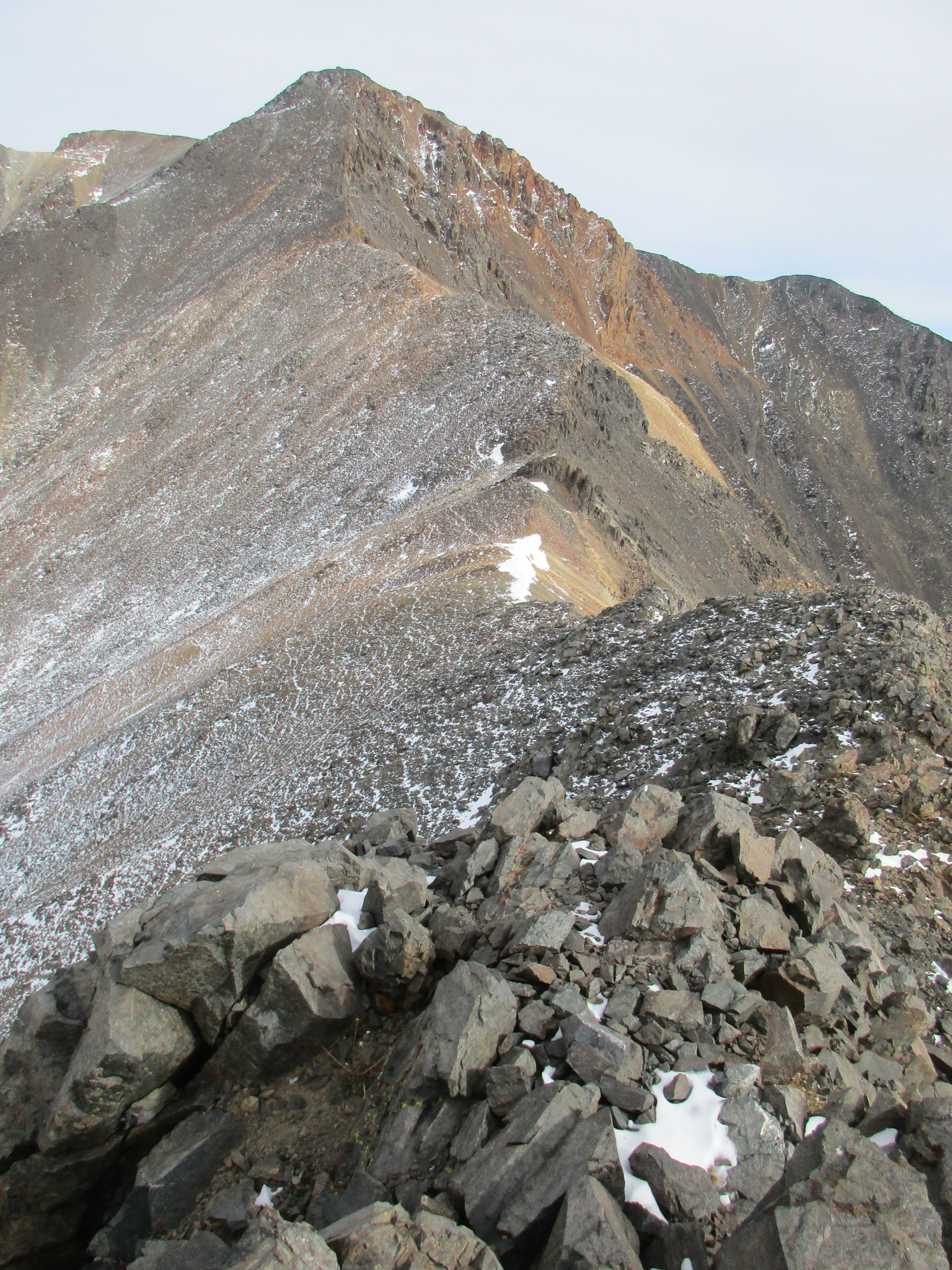
Heaving with exhaustion from the many thousands of elevation feet already gained I gazed upon the long ridge leading to the summit. It seemed that even from this great distance the weather station could be seen protruding ever so slightly atop the summit plateau. This serves as a beacon to peakbaggers. I had a fun time on the ridge traverse. The rock is relatively loose but the mind is sure to be stimulated by the routefinding problems so posed. Rare bouts of fun climbing movement may be found here and there.
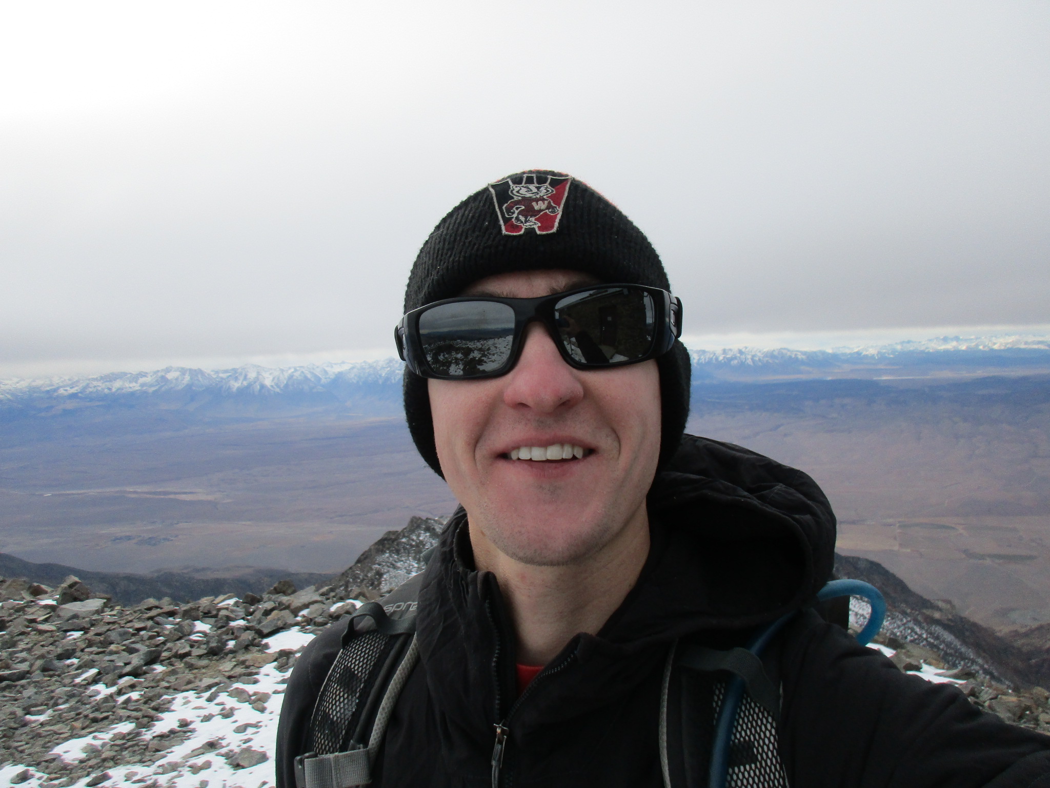
Throughout the day I had given myself goal times for reaching the summit. At the day’s outset, 11:00. At Black Eagle Camp, 12:00. Above the damned scree slope, 13:00. And finally, on the ridge, moving more and more slowly, at 14:00 I stumbled fatefully onto the final summit. Yeah! Taking a few precious moments to sign the register, snap my summit selfie, and gaze upon seemingly the entire Sierra Nevada range (really, do you realize that upon topping out almost any Eastern Sierra peak, White Mountain Peak can be seen in the distance?), I then began the business of descending scree hell madness.
I managed to traverse the entire ridge and descend the damned scree slope to about 11500′ before the sun set and the sky grew dark. The new moon was out which did not bode well for continued effective navigation. Like the cowboy says in The Big Lebowski…it was darker’n a black steer’s tookus on a moonless prairie night…
As noted by PellucidWombat, I too had decided to descend the south spur variation of the west ridge. I surmised from the topographic map and earlier sightings of the ridge during the day that the south spur would consist largely of…you guessed it…more loose scree. This thankfully proved to be the case, and I was able to connect a variety of scree ski pow runs down the ridge. It was fascinating to see how my sense of direction was so easily altered in the blackness of the night. I found myself checking my heading almost every other minute the whole way down, and often my sense of direction was off by up to 45 degrees! If I were to follow a heading of such incorrect magnitude for any appreciable period of time, it would be possible to lose the ridge entirely!
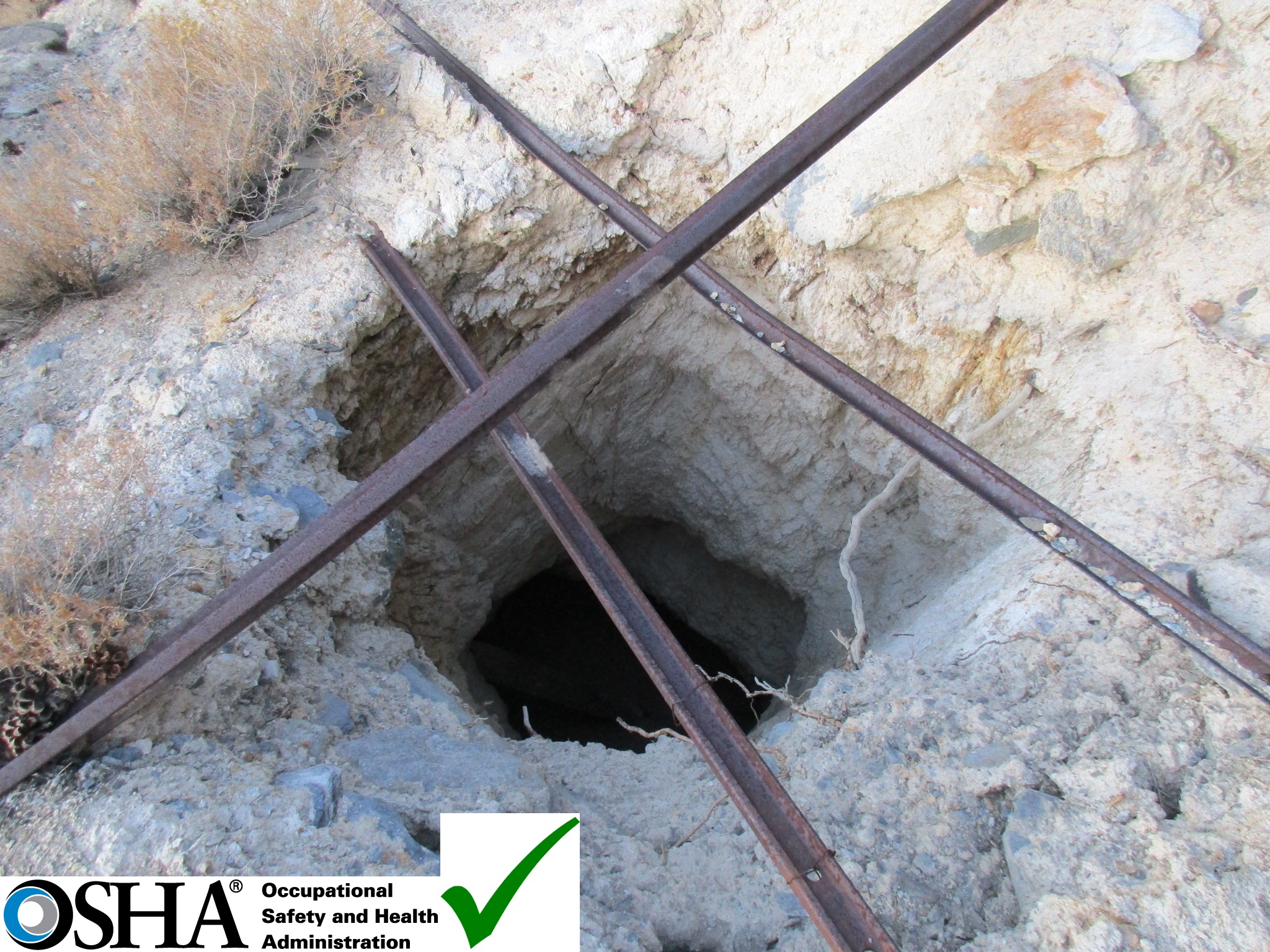
By some mystical peakbagging grace only once did I encounter a major impasse: a horrifying rocky waterfall cliff that plunged out of the small cone of headlamp light and into the black. I immediately scrambled north out of this dry watercourse and not long after found myself back at the mine. Or at least nearby, I never did spot the cozy camp or open holes left by the miners (thank God), but instead stumbled onto the trail, for which I had been ever so diligently looking.
A bivouac at the Black Eagle Camp was briefly under consideration, but suddenly a singular thought penetrated my mind — that of cheeseburgers in town. The goal of many a day hiker. The trail treated me very well, the miles rolled by, and soon so did the cows now slumbering gracefully in their valley paradise. Such joy I have not felt in a long time upon sighting my trusty Honda Civic beside the road; it had done an admirable job getting over a few rocks here and there at the outset of the day, which now seemed a lifetime ago.