Mt Sill: Nee-ma-mee-shee, Guardian of the Valley
31 August 2014
I am putting the convoluted recollections of my trip to Mt Sill onto paper many months after returning home. To avoid any romanticization of this grand journey, during which efforts no less than Herculean were summoned to reach the summit of Nee-ma-mee-shee, as the Paiute have named her, or the Guardian of the Valley, from whose highest heights the finest views of the Sierra Nevada are beheld, I will be brief.
I embarked up the North Fork of Big Pine Creek from the overnight trailhead at about midday. I saw many day hikers milling about enjoying themselves by the rushing stream beside the trail. This is one of those popular trails where one will find not solitude but something else, something maybe just as enjoyable – that being endless opportunities for conversation with strangers of a like mind, strangers looking to get out and experience nature. For example, on my way out near the trailhead, I came across an old man who talked to me of his climbing experiences in his younger years. He had been in the Navy, lived in Bishop for a time, and had just completed a weeklong backpack across Bishop Pass, somehow or other ending up at Big Pine Creek. We were even able to laugh about a story we had heard about Norman Clyde – when confronted with an unplanned, uncontrollable fall toward the bergschrund beneath the U-Notch, instead of giving in to fate he instead launched himself over the gap in legendary fashion. One simply cannot find conversation of this satisfaction in the bars and slums of the cities.
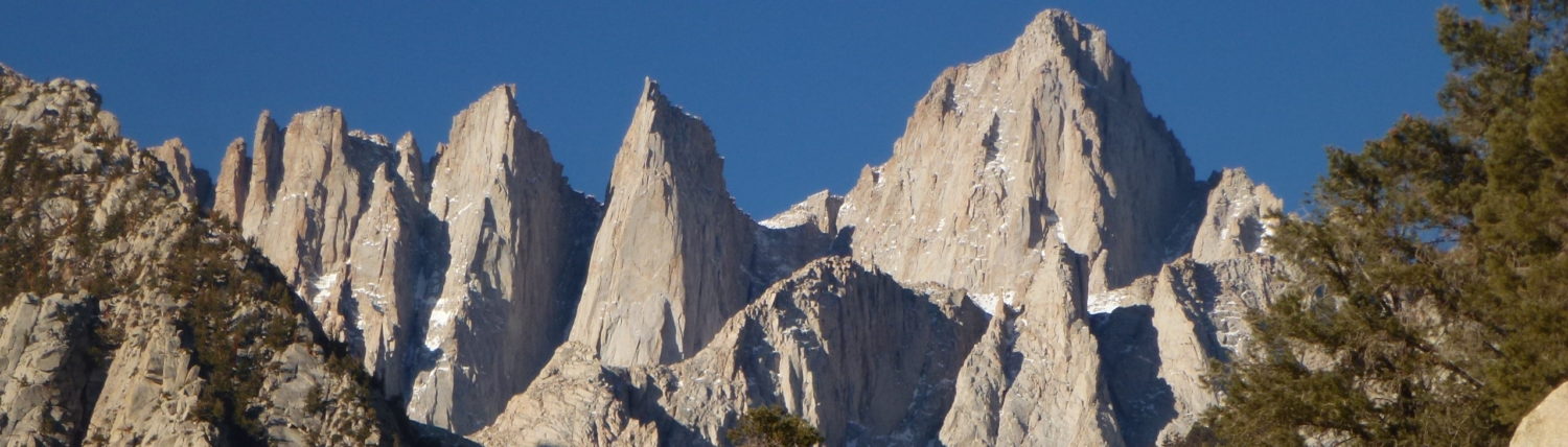
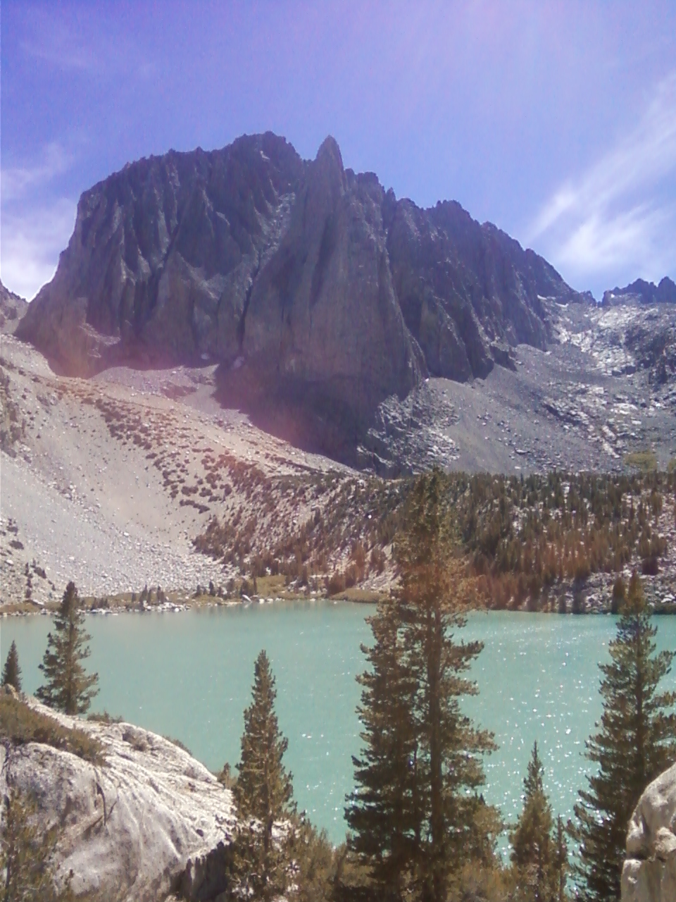
Nonetheless the hikers began to thin as I came upon First Lake. Or was it Second Lake? I may have misplaced a lake. The dark, mangled spires of Temple Crag towered over the opaque turqouise lakes, and I was once again audibly shaken. A few nearby hikers chuckled at my unintelligible gasps, and small talk ensued. The hikers talked of going for Mt Sill in the morning, but their bedraggled condition did not inspire confidence. I decided to press ahead. ‘Maybe see you at camp,’ I called back down to them. The trail was well maintained, and progress came easy. I made the turn southward onto the Glacier Trail. I came across two young chaps with their trusty dog at a stream crossing. We shared a few laughs, and I gave the beast a few affectionate pets.
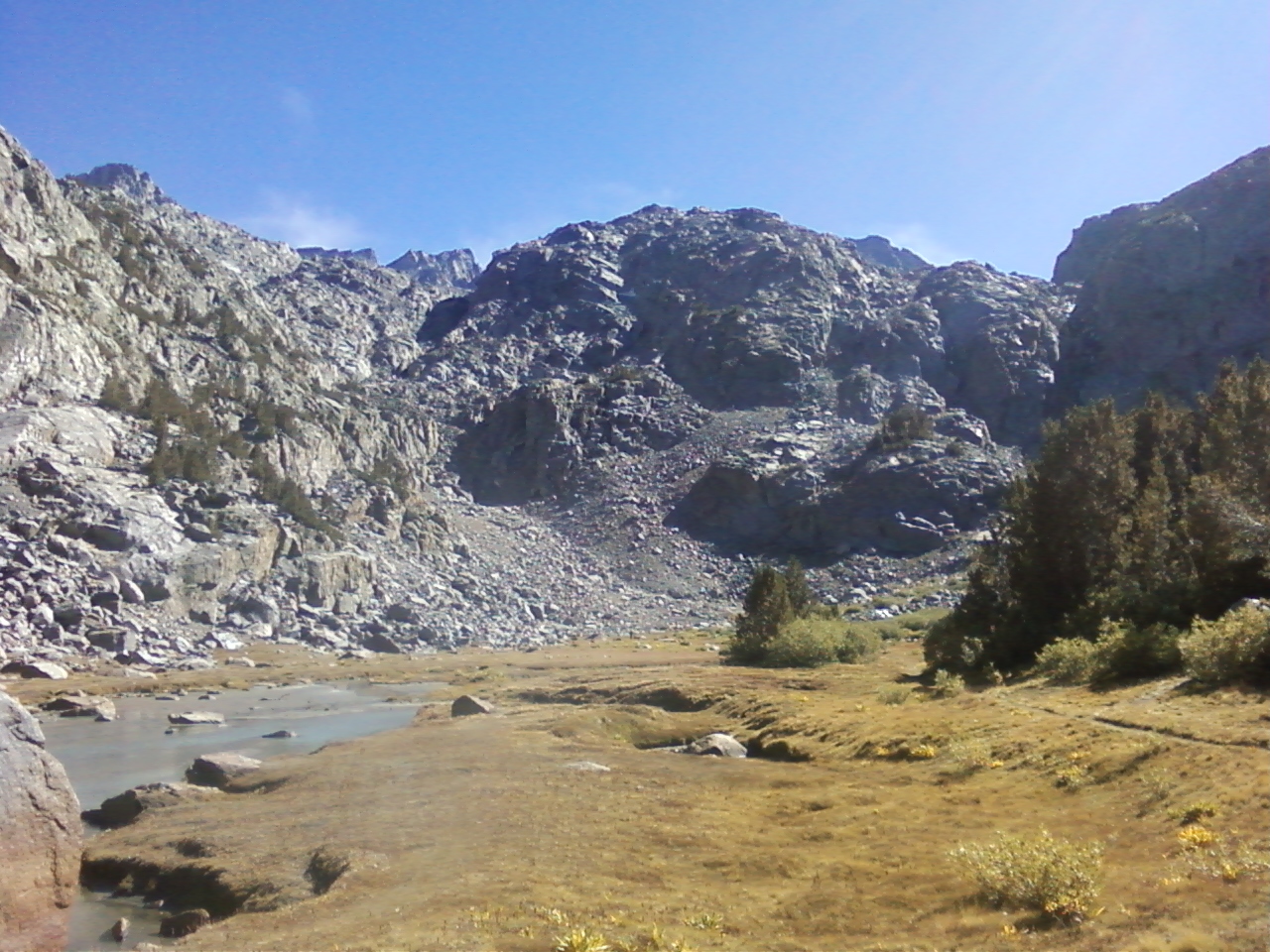
A mere three hours into the journey, I walked up a few more moderate switchbacks to gain an unassuming bench, and lo stumbled upon a true gem, Sam Mack Meadow. Here are pebble strewn streams winding through lush green grasses, interspersed with alpine wildflowers set within an unlikely ampitheater of solid rock. Feeling utterly delighted, I casually approached two pretty young women bounding about the streams, under the guise of filling up my water bottle of course. ‘I see you’re enjoying the meadow!’ I exclaimed wryly. They laughed and explained that they were having a ‘photo-op,’ in the parlance of our times. They further noted their travails in surmounting the ampitheater so as to reach a vantage point of the Palisade Glacier, their main objective of the day. I agreed that the rock looked quite steep near the top at the far southwest end of the meadow. They mentioned that during their earlier reconnaissance they came across a use trail leading east up and away and beginning near the stream’s outlet from the meadow. I thanked them for doing all the hard route-finding work for me! Afterward I assured them the meadow was a fine consolation, and that the glacier would always be there, at least for a few more years. We laughed about my incredibly savvy climate change joke, and I took their picture together. Soon they bounded away before I could even learn their names.
I set my bivy bag down in the meadow. If I was a true environmentalist I would have camped in the rocks to minimize my impact, but this bed was too soft to pass up! The young chaps and their dog came up the way and set their tent in the meadow as well. I gave the little fella a few elbows to keep him out of my beef jerky. ‘I’m gonna need this energy come morning!’ I chastised the beast. The colors evolved on the rock as the sun set. Sleep came easy, and I rose at first light feeling remarkably refreshed.
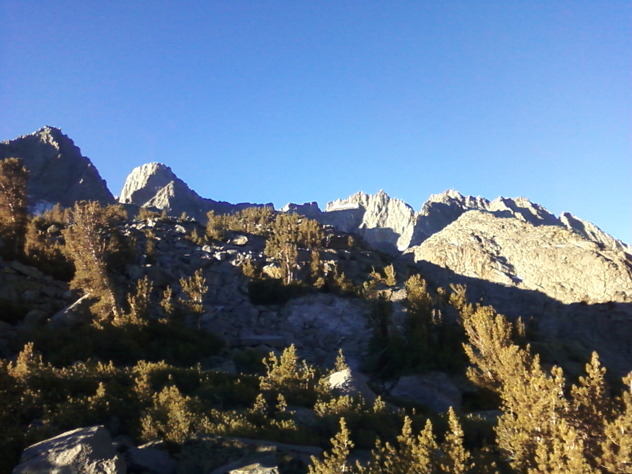
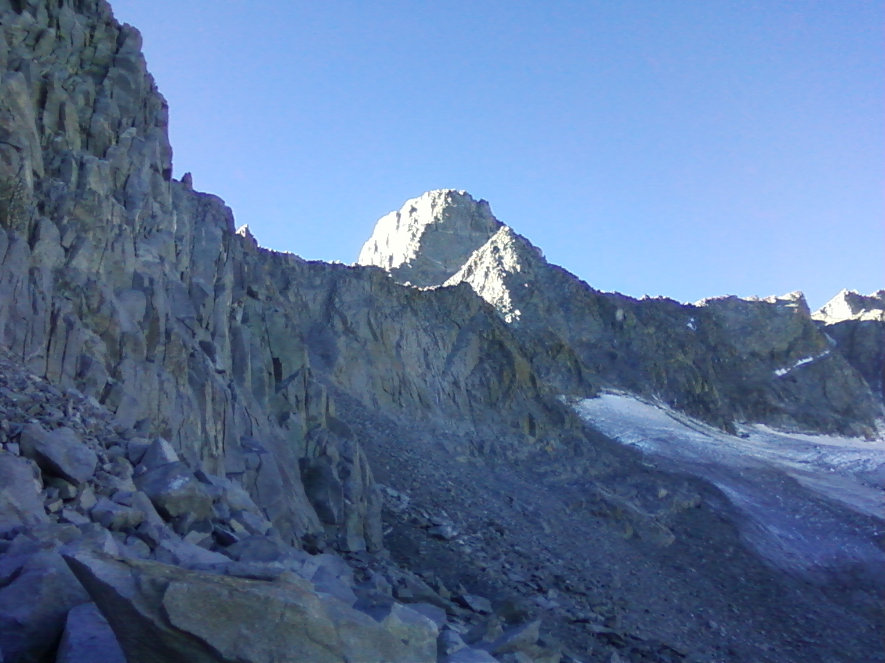
I made my way up the use trail, which beneath Mt Gayley all but disappeared, a tradition which I have become intimately familiar with during my high altitude travels. The view of the Palisades was nothing short of breath-taking. Yet the glacier had become gaunt and saturated with shavings from the mountainside. This did not bode well for my photo-op or more importantly, for my progress across the interminable boulder field. What seemed like a huge waste of time later, I finally found myself beneath the notch. I scrambled desperately upward and set off a small landslide of extremely loose glacial till. The extent to which the glacier had receded was painfully obvious by the amount of loose materials wretching about beneath the notch. I retraced my steps and found a ‘better’ way up. I was glad to be on solid rock atop the notch, and immediately realized that the situation I just found myself in, although seemingly benign, may well have been the most dangerous I’ve yet encountered in the mountains. My legs could have easily been caught up during the landslide and twisted and torqued into a horrid mess.
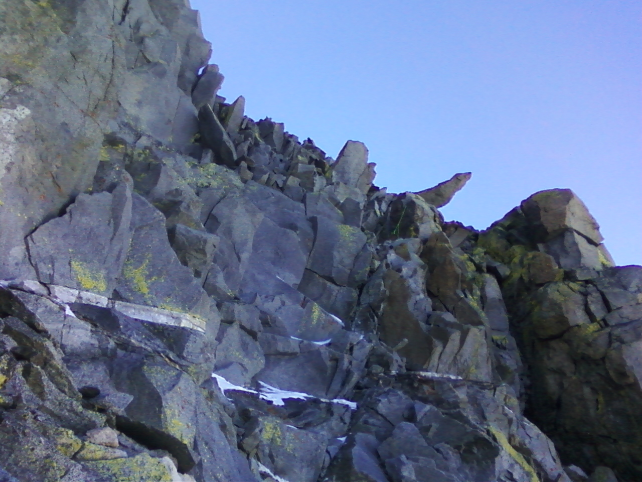
I cleared my head and looked upward only to see the North Couloir completely melted out! I alternated ascending the class three terrain on the far left and right sides of the couloir, successfully avoiding the loose crud in the center. I peeked over the top at the ledge traverse and shuddered at the exposure. ‘I don’t know if I can do this,’ I thought to myself. ‘Just take it one step at a time. You don’t need to go any further than you are comfortable going,’ I reassured myself. I knew my first foray into class four climbing lay in wait at the end of the ledge traverse. Now I rose to my feet again. As it happens, rising to my feet, and overcoming the fear that gripped me upon first viewing the traverse, was the hardest step. I walked across the ledge, reached up and around a few slings, chimneyed between a few truck size boulders, and ‘Yes!’ emerged victorious onto the spacious summit plateau. That familiar and undefinable feeling of ecstasy, relief, and trepidation at the downclimb to come washed over me with cleansing purity. I became fixated on the North Palisade, so close now, and vowed to climb it next season. The thought of it inspires both anticipation of a noble quest and sheer terror.
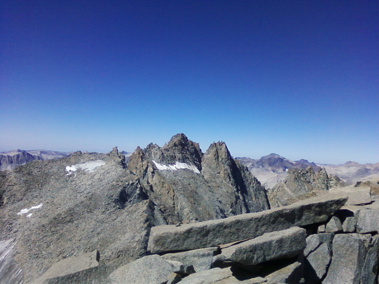
I lounged about for a time, sunning myself on the summit plateau, which I had all to myself. It was quite pleasant up there. I drank a good deal of water, ate some fruit snacks, and again cleared my head for the descent. Descending the couloir via scree ski was surprisingly enjoyable. Now Mt Gayley and the Golden Brick Road rose right in front of me. I longed to climb it, but was too tired now and worried about the loose rock waiting below. Maybe next time, Gayley! I took great care in descending from the notch, and came across a group of climbers having great difficulty, as I did earlier in the morning. I gave them my best advice on getting to the notch. I learned they were planning to climb the Swiss Arete. Upon a few inquiries on their part, I relayed to them my best description of the descent via the ledge traverse. The trick is to know when to hop over from the south side of Mt Sill onto the traverse back to the couloir. I wished them the best, and thought to myself, ‘Seems they should have started a technical climb much earlier than midday!’ But what do I know, I am a simple Sierra scrambler.
Now this next part I do remember quite vividly and hereby allow myself ample room for hyperbole. The walk back across the boulder field toward the use trail was endless and hellish. I did not know such large boulders could be so loose. I must have had more wits about me on the way in, perhaps taking a better line across the field. Now I think of it, I was probably lower on the field on the way in, likely finding marginally stable rock lower down. It may be that this climb toward Mt Sill is best undertaken earlier in the season, when more of the boulders are covered with snow and stabilized by ice blocks. However after a number of consecutive dry years, the glacier has receded so far that it offers little in the way of progress toward the base of the notch. And this late in the season it looked to be extremely slick, requiring the use of ice tools to travel safely across the steeper sections anyway. All speculation aside I was glad to reach the use trail back to Sam Mack Meadow once again, but sad to leave such a fine sight behind me. I took a sublime jump into the rushing waters of the stream and walked back down the trail under fading light.