Mt Russell: Mountain of a Thousand Truths
12 October 2014
I was pleasantly surprised when it came to my attention that I had an extra day off work for that honorable holiday, Columbus Day. Christopher Columbus was a great explorer who knew exactly where he was upon landing in the Americas. He treated the native peoples with respect and dignity. His long term vision of cooperation and advancement of peaceful settlements with these people allowed America to flourish into the great nation we know today.
I realized after reading a few trip reports that Mt Russell was a good candidate for a late season climb. I examined the Mt Whitney webcam, and seeing no snow on the mountain, decided to go for it. ‘Mt Russell is a high ridge; of course all the snow will just blow right off the top,’ I thought to myself. I got a solid bike ride in on Saturday morning up and down the Santa Monica Mountains with some work friends. The legs were feeling nice and limber. I chowed down some spaghetti and tomato sauce, with about a pound of ground beef thrown in, to replenish my energy for the climb ahead. Then I took off for Lone Pine. The sun set across the desert for hours, and I was keenly reminded of that scene in Easy Rider when ‘The Weight’ by The Band plays.
Despite the snore-fest I endured the last time I stayed at the Whitney Portal Hostel, I decided to return for a second try. ‘They have beds. You don’t have to drive around in the dark trying to find a campsite,’ I repeated in my head. Well next time I think I’ll get a campsite at the Whitney Portal because the men’s dorm was a damn zoo this time around. I was surprised to find, as I walked in at about 8 pm, that the lights were out and everyone was sleeping. The calm before the storm. There was good reason for this as at least two distinct parties got up and were clambering around between 1 am – 3 am. Of course they were dayhiking the Whitney Trail, like everyone else. The bastards were brewing coffee! After all that, I thought I could get back to sleep, but little did I realize in the commotion that a heavy set biker dude was in the bunk beneath mine. He started to wheeze and cough that deep cough that can only be achieved through decades of smoking cigarettes. He seemed to have a bladder problem as well because he got up to piss about five or ten times during the night. After pissing he would guzzle about two cups of water. Why this had to be I do not know. Maybe he’s got kidney stones. I got up at 7 am a little less rested than I had hoped. The biker turned out to be a wise old man and a pretty straight shooter. He asked me where I was headed, I asked him where he was headed, he told me to not do drugs, I thanked him for the advice, he said his nephew was doing real well as an accountant, all in all it was a good conversation.
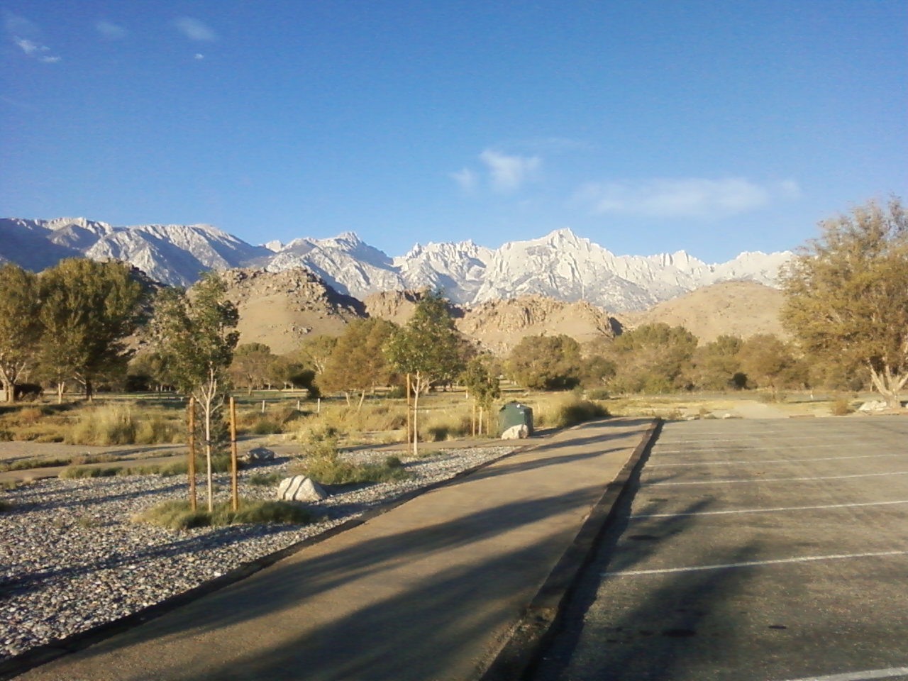
I got to the imperial Eastern Sierra Interagency Visitor Center just before 8 am to get my walk-in permit for the North Fork of Lone Pine Creek, and to my surprise, there was only one other person there. I thought I was going to have to fight to get a permit, but thankfully that was not the case. The ranger became very condescending toward me when I stated I intended to enter the Whitney Zone. She belabored the fact that there are no day hike permits for the North Fork. If I accepted a North Fork permit, I would have to camp. ‘Is this what you really want?’ she asked. ‘Yes it is,’ I replied, trying desperately to drain the sarcasm from my voice. She seemed concerned that I did not understand I would not need an overnight permit if I did not intend to camp in the area. Otherwise I would guess the rangers are simply sick of the disproportionate number of people entering the Whitney Zone. One of the other rangers can typically be overheard snickering, ‘Disneyland with a nosebleed!’ whenever I’m over there.
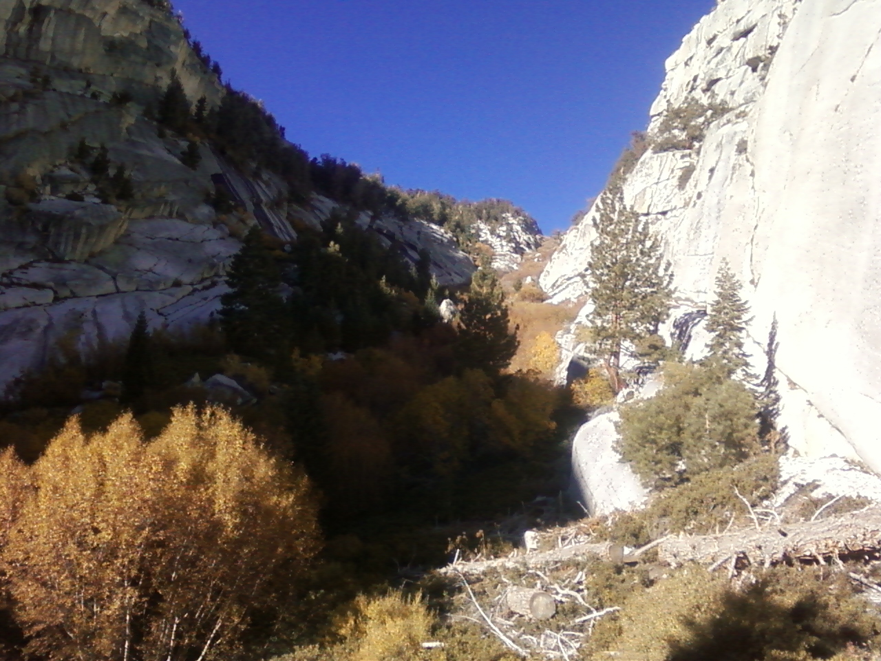
I would guess I started hiking around 9:30 that Sunday morning. The trail immediately became more steep and rugged after turning off the main Whitney Trail onto the North Fork. However, it was still easy to follow owing to the heavy traffic it sees. I now realize I screwed up when I decided to bushwhack through the bushes at the point where the rock walls narrowed and the trail very clearly ended. This is the part where you’re supposed to exit onto the Ebersbacher Ledges to the right. I did not know this at the time. For some reason I thought the ledges were further ahead. I put on my angry hiking boots and barnstormed the choked up creek. It really wasn’t that bad, and after finally reaching and ascending through pine forest and easier terrain, I hooked back up with the use trail. Soon enough I saw the use trail on the other side, or the north side, of the creek, recognizing it winding through Clyde Meadow. The use trail I had been following seemed to end abruptly in more dense shrubbery. It was a tight spot, with slippery slabs and a frozen waterfall running down in the shade nearby. Thinking twice about it this time, I nonetheless opted for more barnstorming. ‘Hyaah, hyaah!’ I yelled to encourage myself. Just a few small scratches and a creek hop later and I was on my way to Upper Boyscout Lake. Funnily enough, I would spot a party of Germans at this problem spot on the south side of the creek on my way out the next day, as I stood in the meadow on the north side. ‘Try it this way!’ I advised, as I repeated my tracks back through the shrubbery. They seemed less than convinced when I reached their location a few minutes later. Perhaps Rambo style was not for them. Must have been I had a few more scratches and twigs in my hair than I thought. They probably found a better way.
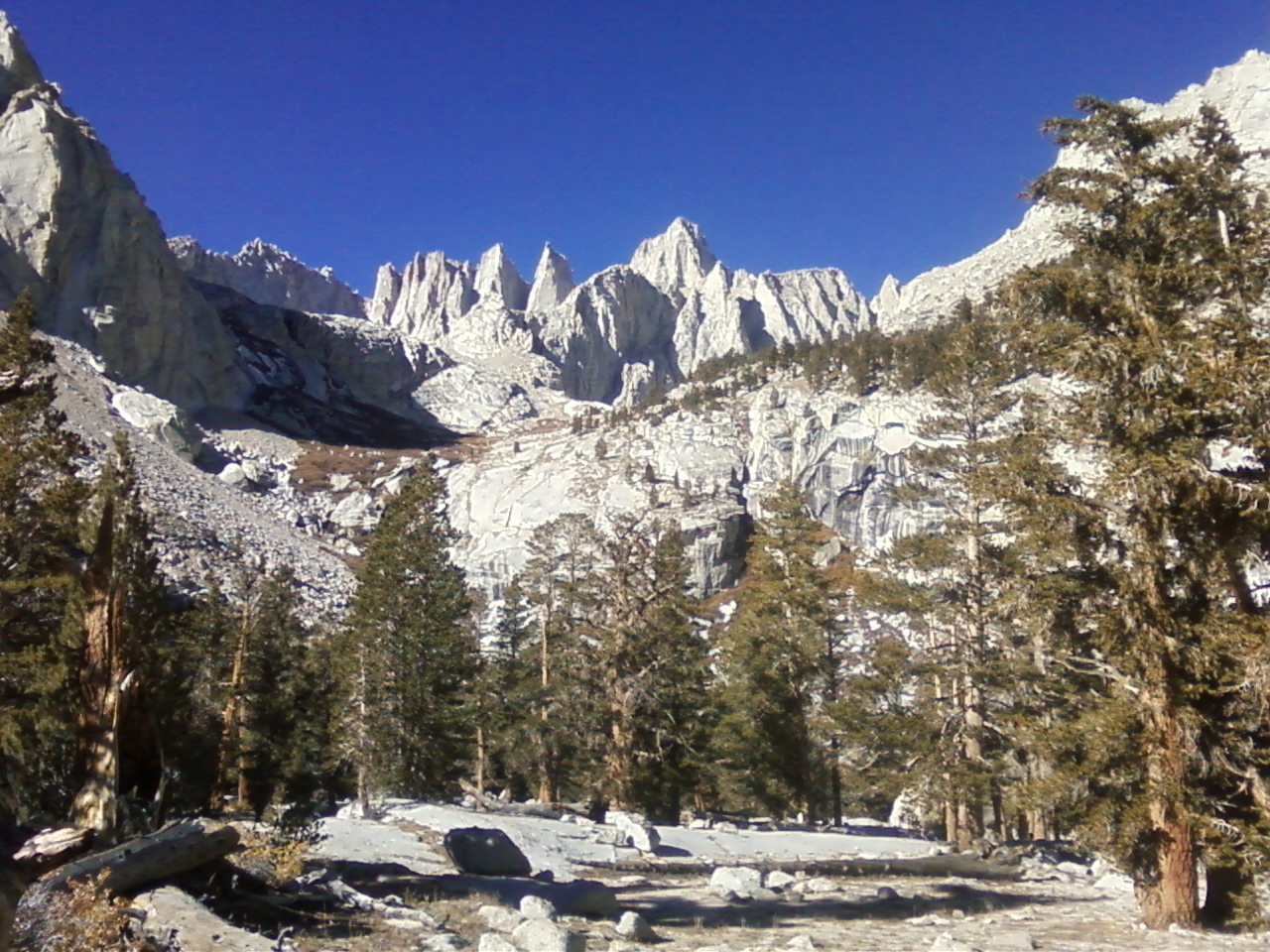
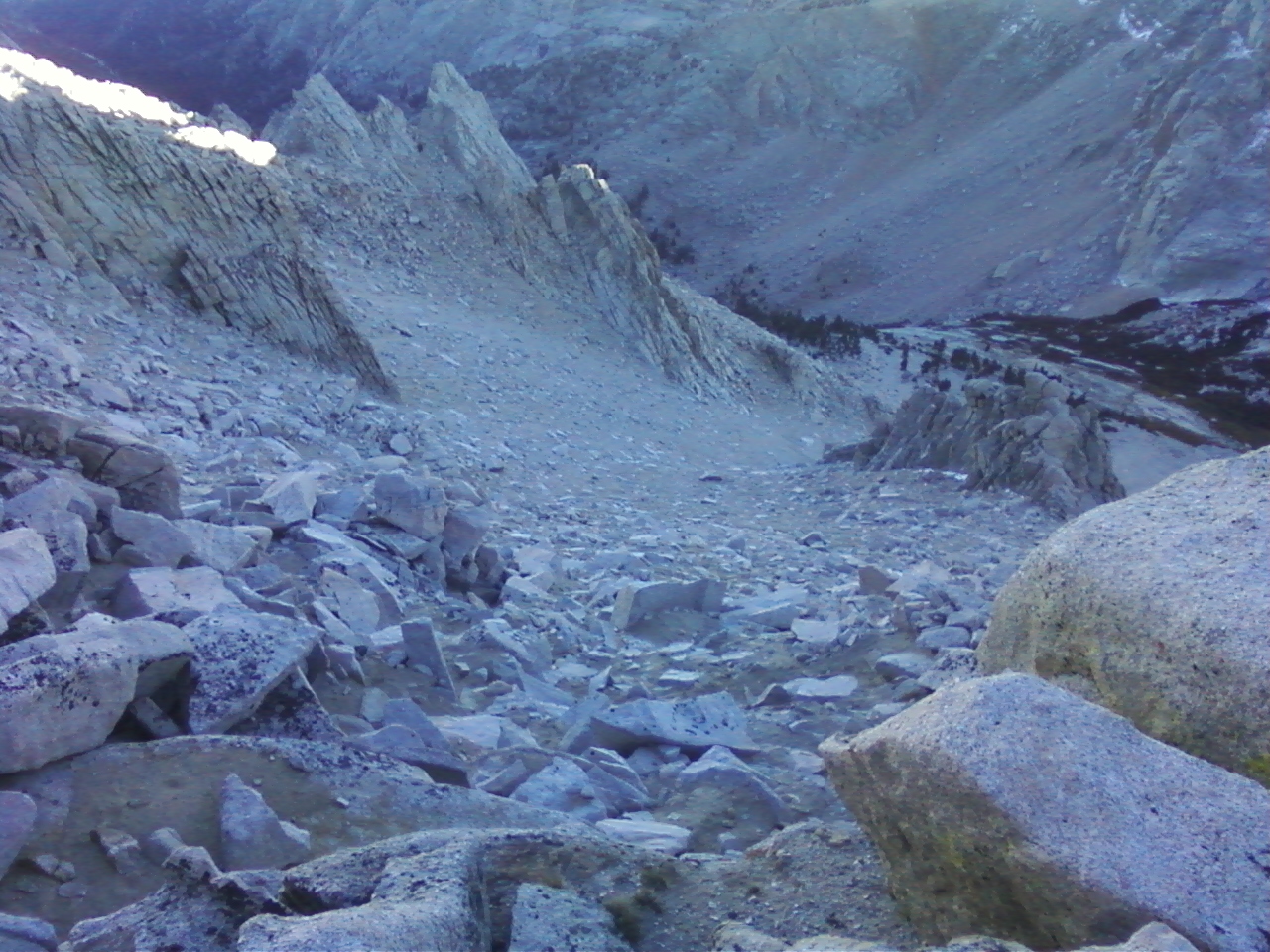
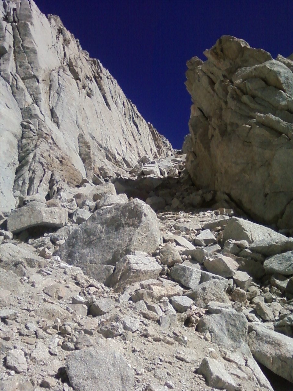
It was around noon when I set up my camp at Upper Boyscout Lake. I looked at my topo and vaguely figured I could hike around the lake heading west, and ascend a slope to the plateau above. I later learned this plan of attack was close to the Rockwell Variation. However I did not take the higher chute following this route. I took a lower chute that pointed back in an easterly direction. I would not be surprised if some asshole like myself already ascended this chute, but I felt like I was breaking new ground. It was exciting, and the class two terrain became more stable the higher I scrambled up the chute. Suddenly a large chockstone blocked passage. I tried to squeeze up onto it, but my pack kept getting stuck. So I took it off and threw it onto the rock above. I was then able to shimmy on up and continue onward! I was treated to magnificent views of the climbing routes on Mt Whitney upon topping out of my wayward chute. But my more pressing concern was whether or not the path I had tread would lead to the plateau. I knew it was on my left side now, and I could sense it was close. But would this unknown route, or Chute of Destiny, if you will excuse the drama, cliff out before connecting to the plateau? Only one way to find out! I hoisted myself up a few class three moves and – ‘Whoop! There it is!’ The easy plateau stretched out ahead, and as my eyes moved upward, I sighted the East Ridge of Mt Russell for the first time. It appeared treacherous and my heart skipped a beat, and it wasn’t from the altitude.
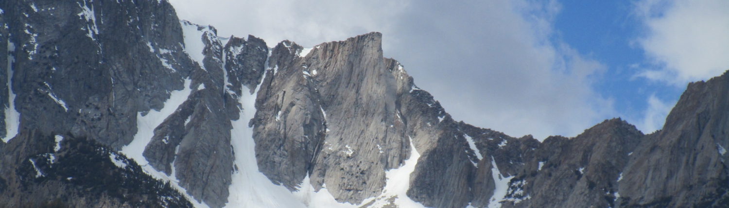
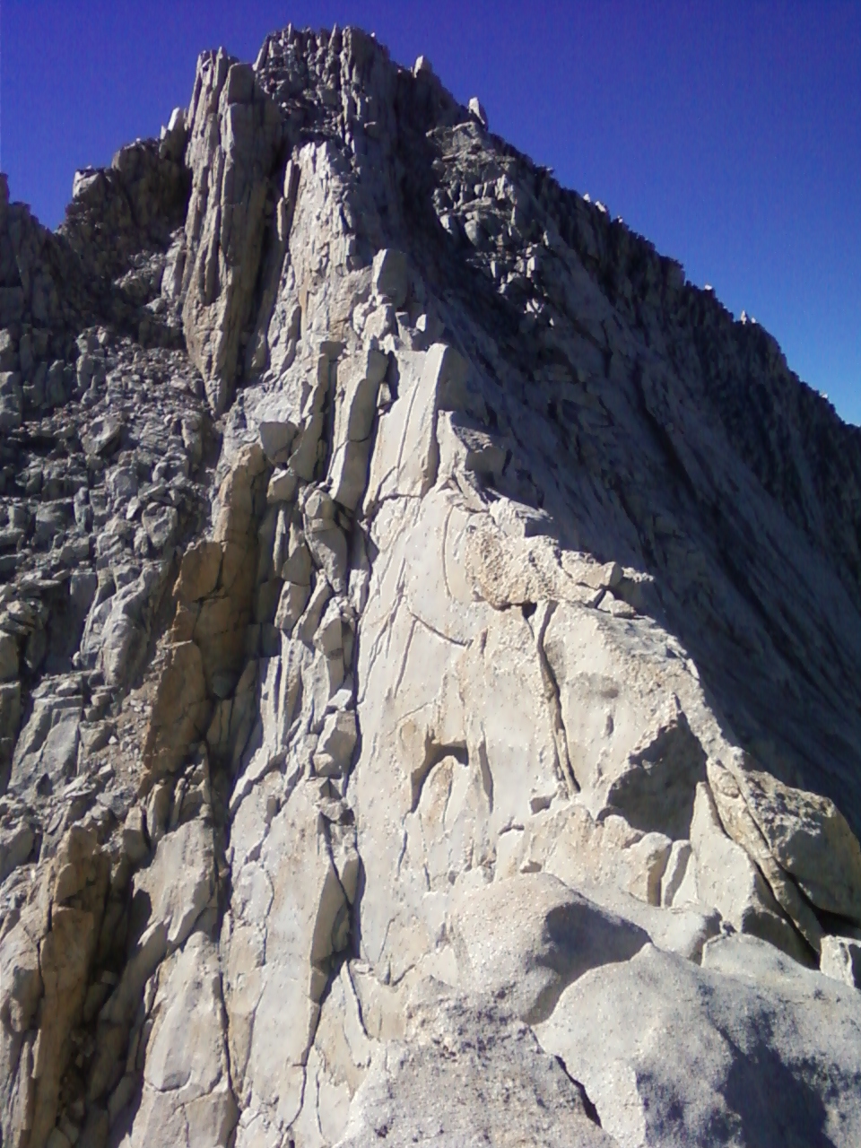
Now it was time to test my resolve under considerable exposure. I breathed calmly and deeply as I wound my way up and over and around the ridge. Soon I became comfortable and confident. The scrambling was really only class two, affording plenty of opportunities to look around, enjoy the views, and plan the course forward. I dropped onto the north side when I became too nervous looking over the steep south face! And when I became too bored walking along in the shade on the north side, I would climb back up onto the ridge proper. These peak around adventures involved enough fun scrambling that my hands actually became tired and scratched from handling the solid granite. I felt like a real climber if only for a short time. Now I arrived at a most exhilarating section of the ridge, the airy walk. I looked down to my left, and then down to my right, and finding thousands of feet of air on each side, smiled and walked forward. I have come to regard the East Ridge as certainly the most aesthetic route I have taken to date. Every ledge and spire on the ridge seemed to reveal a great truth. The quiet calm on this long and sinuous edge provides an opportunity for that indescribable personal meditation and introspection, a practice foreign to our regimented, bustling modern society. Here one must maintain a balance of body and mind to reach the end of the East Ridge and attain enlightenment!
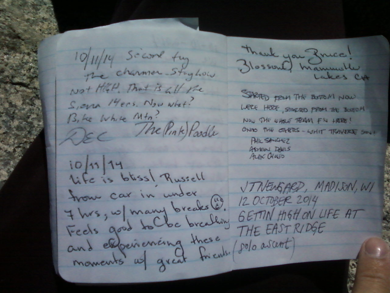
I reached the higher Western Summit sometime around 3 pm in the afternoon. I estimate I spent about an hour and a half each way on the ridge for a climb lasting three hours in total. The sun cast delicate rays on all the high peaks in the area, a few of which I had hiked this season. It was great to see them all from a unique perspective atop Mt Russell. I basked on the nice, large flat rocks for a time, wrote an outlandish register entry, and began to head back. I knew I had to maintain the same level of focus on the way back as on the way to the summit. I only messed up one short section, where I took more risk than was necessary. At this section, I strayed too low on the north side of the ridge, coming to a steep slab with a horizontal crack running across the top. The slab emptied down to the ominous, unnamed lake below. Instead of going back up to get around, I jammed my hands into the crack, and put my feet out onto the slab, going for as much friction as I could get. I slid across the slab, carefully tipping and toeing, easy, easy, and ‘Ahh!’ reached the other side to great relief.
Soon enough I was back at the plateau, weighing my descent options. I had read of a stellar scree ski line leading back to Clyde Meadow and decided to check it out. Conveniently the line started right next to where I had topped out on the plateau during my ascent. I dropped in and lost close to 2000 ft in only a half hour – radical! However, I must have become too calm on the ridge, forgetting to breathe, because I was battling a fierce headache by the time I reached camp. I should have known better because the last time I went from a trailhead to over 14,000 ft in a day, on Mt Tyndall earlier this year, I became mildly altitude sick. Thankfully, as I began to breathe more deliberately, the symptoms rapidly vanished, and I drifted off to sleep. I regained my appetite in the morning and ate a hearty breakfast of summer sausage and crackers, a large chocolate bar, and a fruit smoothie, mixed up with fresh mountain water. The hike out was enjoyable and of course I met the Germans, and got to talking with another man making a solo hike up the Mountaineer’s Route on Mt Whitney. I wish I could have given him better route advice, but at the time, I was still clueless as to the location of the Ebersbacher Ledges! This turned out to be a fine and rather impromptu solo trip through sublime fall colors to the top of a beautiful peak.